The Mount Whitney Challenge
Jennifer Ronda
Recently, I overheard someone talking about their plans to attempt to summit Mount Whitney in one day. My first thought was, "Where is Mount Whitney? I've never heard of it before. I need to Google that." (Okay, so that was actually three thoughts.)
 Mount Whitney. Photo credit: Geographer, Wikimedia CommonsThen when I heard this person say it's the highest summit in the lower, contiguous 48-states, my next thought was, "I want to do that someday!"
A few years ago, Matt and I successfully summited Half Dome in Yosemite National Park in one day, so hiking Mt. Whitney sounded like an adventure we should try someday; the next big challenge; something to add to my ever-growing bucket list. (Which now stands at over 4 pages long, and I'm starting to think I may not be setting myself up for success in completing all the items.)
But it wasn't until a recent visit with some friends that the generic "someday" would turn into a very specific date in late September.
As it turns out, our friends are planning to hike Mt. Whitney this fall. Not only were they able to obtain a much sought-after day-use permit for themselves (a permit is required to hike on Mt. Whitney), but they had extra permits and invited us to join them on this demanding and extreme one-day hike! (I'm sure to some that doesn't sound like an enticing invitation. Our friends obviously know their audience quite well.)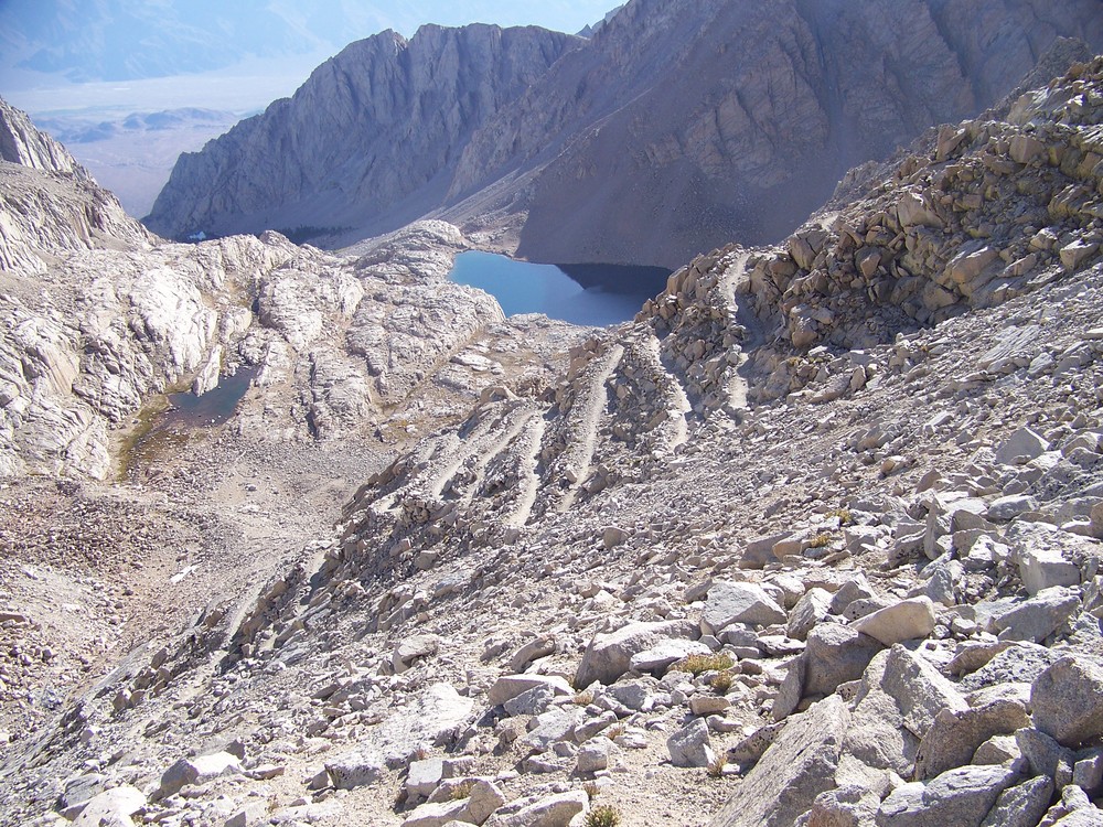
This was opportunity knocking. A chance to spend time with great friends and create unforgettable memories. An epic hike with my husband on new terrain. A possibility of checking off an item from the bucket list. I could feel that obscure and latent competitive gene of mine floating to the surface.
So then, why did I suddenly have a huge pit in the bottom of my stomach, feel apprehensive, and hesitate in immediately accepting their invitation? Oh, that's right: fear.
Fear of failure. Fear of not making it to the summit. Fear of getting altitude sickness. Fear of having to give up and turn around. Fear of not succeeding.
After mulling it over for several days, I realized fear is a pretty stupid reason not to even give it a try. How unfortunate (and dare I say, cowardly?) it would be to completely pass on this opportunity just because I'm afraid I may not complete the ascent.
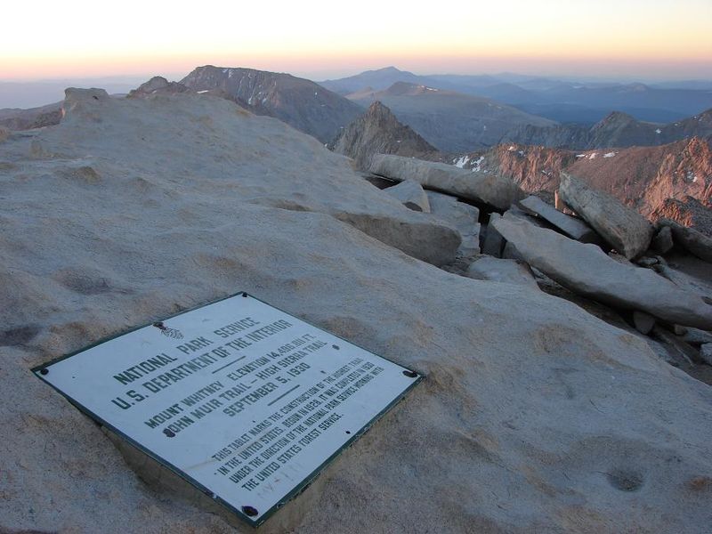
So, challenge accepted! We'll attempt to summit the 14,505 foot tall mountain in a single day via the Mount Whitney Trail.
And even if failure becomes inevitable, I know it will still be an amazing day with incredible scenery, and it will be time well-spent with my husband and wonderful friends. I'll just have to submerge that competitive gene and save it for another challege.
Facts about the hike
- Mount Whitney elevation: 14,505 feet
- Total distance: 22 miles round-trip
- Trail begins at Whitney Portal, elevation 8,360 feet
- Elevation gain: over 6,100 feet
- Timing: Requires 12 - 18 hours of strenuous hiking
Training Hike #1: Shirley Lake Hike, Squaw Valley, Lake Tahoe
Yesterday we undertook our first "training" hike to help prepare us for the Mount Whitney Challenge.
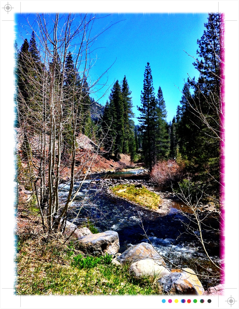
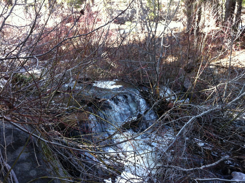
Listed as a moderate to difficult hike, the Shirley Lake Hike was close to 5 miles round-trip. True, the distance covered was nothing compared to what we'll need to do on Mt. Whitney, but the hike had a 1250 foot elevation gain, had steep sections to navigate, and there was a lot of scampering over large rocks and granite slabs. Our legs definitely got a work-out! And the scenery was amazing: we passed several waterfalls, had a wonderful view of the valley below, and glimpsed Shirley Lake (which we've been to before, but this was the first time seeing it without snow covering it!).
And Mother Nature so graciously contributed to our training by bestowing upon us an array of weather conditions! Initially, we had the 80+ degree temperature and hot sun to contend with. Then, almost out of nowhere, dark and threatening clouds appeared (this too served as a training point: as soon as you see storm clouds, descend!). Lastly, and completely unexpected: hail! And lots of it.
We sought out shelter the best we could, but it soon became apparent that the storm was not letting up. So we completed our training hike in the rain while cautiously, yet quickly, descending the slippery granite, climbing down rocks, jumping over slick mud puddles, hopping over now-gushing streams all while getting pelted with hail.
Let's just hope this training exercise is not entirely indicative of our Mount Whitney adventure!
Training Hike #2: Dipsea and Steep Ravine Trails, Mt. Tamalpais State Park
Our training continues...
Yesterday we completed an 11.5 (okay, 11.47 to be exact; excuse me for rounding up!) mile hike, with a 1,900 foot elevation gain, through parts of Mt. Tamalpais. No major weather events to report, other than the usual coastal fog. We had ocean views (when not obscured by the fog!), walked under thick redwood canopies, followed along running creeks and a few waterfalls, and traversed across sweeping grass fields. We even got to see the Mountain Play Theater atop Mt. Tamalpais.
Matt took a picture of my pedometer as proof of the distance covered on our hike. 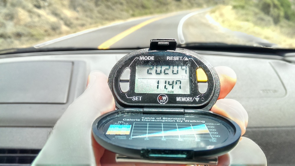
Training Hike #3: Marlette Lake Hike, Lake Tahoe
July 27, 2013. 10 miles in 3.5 hours with 1,200 foot elevation gain. This was our first hike up to Marlette Lake -- what a beautiful, secluded alpine lake! The trail started at Lake Tahoe level (6,224 feet) and was a moderate uphill trek to Marlette Lake. Part of this hike paralleled the famous Flume Trail. Bear (our canine companion) especially liked the part of the hike where he got to splash around and cool off in the lake.

Training Hike #4: North Peak Hike via Mitchell Rock, Eagle Peak, Bald Ridge and North Peak Trails, Mt. Diablo State Park
August 4, 2013.
To sum it up, as the name implies, our Mt. Diablo hike was the devil's hike from hell. Don't get me wrong, it was a tremendous day-long training hike for us and had amazing, sweeping views of the east bay and beyond, but this was way more strenuous than we were expecting. And the 80+ degree weather and very sunny, exposed sections further made us feel like we were climbing our way out of the bowels of purgatory. Much of the hike was a constant uphill climb, with a total of ~2,960 ft. elevation gain.
We took different trails on our way down, expecting (hoping) for some relief but alas more devilish trickery was at hand! We descended some very steep fire roads that were covered with a gritty and gravelly surface that made it precarious and slippery.
Oh, and did I mention all the poison oak? Throughout the entire hike, I kept pointing out poison oak, giving it a wide berth, and warning Matt to stay clear of it. While descending and working hard not to slip (see above paragraph...), guess who fell? And in an attempt to stop the fall, put her hand down directly in a patch of poison oak? Hint: the author of this blog and the person who was paranoid about it all day long! I'm telling you, this was just more of the devil's work at hand!
Training Hike #5 (Solo hike for Jen): Five Lakes Hike, Alpine Meadows, Lake Tahoe
August 13, 2013.
This is a great half-day hike to take if you're ever in the Lake Tahoe area. It's about 5 miles round-trip, dog-friendly, and you get beautiful views of the Alpine Meadows valley and ski resort and the Granite Wilderness area, and you even hike next to some (not in use) ski-lift towers.
Bear (our dog) and I had fun exploring the area to see if we could find all 5 lakes; we found 4. And yes, Bear had to swim in all of them.
It's a pretty mellow hike, with about 900 ft. elevation gain.
Training Hike #6: Dipsea, TCC, Troop 80, Lost and Sun Trails, Mt. Tamalpais State Park
August 18, 2013.
For this training excercise, we took several different trails, some involving some big uphill climbs. Overall, great trails and beautiful scenery. Highlights included Matt hitting his head on a tree, stumbling upon the Alice Eastwood Campground with a meditation seminar in full-swing (shhh! quiet voices only), and hiking past the German Tourist Club (which brought back past memories of an Octoberfest celebration we spent there with friends). Total hike: about 11 miles.

Training Hike #7: Dipsea Trail (Roundtrip), Mt. Tamalpais State Park
Yesterday we completed a roundtrip hike of the Dipsea Trail almost in its entirety (minus about 2 miles of it), and clocked in a little over 13 miles.
Our hike started up on the Panoramic Highway, took us down to Muir Woods Park, then back up (highest elevation reached was 1,360 feet), then back down a series of what seemed like never-ending stairs (all the while knowing we would have to climb back UP these stairs on our return trip!) to sea level. Our half-way point: Stinson Beach where we ate our lunch, watched all the Labor Day Weekend beach goers fire up their grills, and rested our legs.
And yep, all those stairs going back up from the beach were brutal! But we did it. On our return trip we had incredible views of the enormous fog bank which looked more like a giant tundra of snow covering the Pacific Ocean as far as the eye could see.
Completed the entire trail in about 6 hours. There was a lot of up, down, up, down on the trail and we estimate our total elevation gain was about 3,500 feet. Not too bad, and a very good practice hike with only about a month left until our Mt. Whitney climb.
Training Hike #8: Gravity Car Fire Road, Temelpa Trail to the fire lookout at the summit; Northside Trail to Collier Spring Trail and Miller Trail, Mt. Tamalpais State Park
September 15, 2013 --Since this was most likely the last "training" hike before our trek up Mt. Whitney, we wanted a hike that would give us one final challenge. And I think this one did it!
The first part up Temelpa Trail, which was less like a trail and more like a very dried-up narrow creek bed, was close to a 2,000 foot elevation gain and was a fairly direct route right up to the east peak and summit of Mt. Tam. Phew, that got us sweating!
We had a bird's eye view from the summit: we could see boats in the bay that were lining up for one of the America's Cup races, the tip of the Golden Gate Bridge, Mill Valley, across the bay to Mt. Diablo, and we even had a clear view of the Farrallon Islands! So we know the visibility on this day was at least 25 miles!
We then headed for the north side of Mt. Tam, taking the...wait for it... Northside Trail. This relatively flat and shady trail was a nice break after coming up the Temelpa Trail.
Next, we branched off Northside Trail to take Colier Spring Trail. And basically climbed up what was equivalent to a 50-story building! While short in distance, this trail took us up from about 1,800 feet to 2,300 feet. And no, there was no elevator to take us to the top.
Finally, Miller Trail to Hogback Fire Road which were mostly downhill. Hey, we need practice hiking downhill, too!
Total mileage: about 9 miles. If we're not ready for Mt. Whitney at this point, I don't think we ever will be!

