Contact Us

Use the form on the right to contact us.

You can edit the text in this area, and change where the contact form on the right submits to, by entering edit mode using the modes on the bottom right. 


San Francisco, CA
USA

Blog

Filtering by Tag: Hiking

Ready or Not, Here We Go!

Jennifer Ronda

Since this was most likely the last "training" hike before our trek up Mt. Whitney, we wanted a hike that would give us one final challenge. And I think this one did it!


We headed to Mt. Tamalpais State Park, and the first part of the day was spent on Temelpa Trail, which was less like a trail and more like a very dried-up narrow creek bed. This trail had close to a 2,000 foot elevation gain and was a fairly direct route right up to the east peak and summit of Mt. Tam. Phew, that got us sweating! 

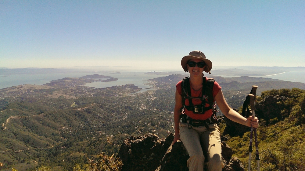
We had a bird's eye view from the summit: we could see boats in the bay that were lining up for one of the America's Cup races, the tip of the Golden Gate Bridge, Mill Valley, across the bay to Mt. Diablo, and we even had a clear view of the Farrallon Islands! So we know the visibility on this day was at least 25 miles!On the Mt. Tamalpais Summit, with the Bay Area and Pacific Ocean in the background
We then headed for the north side of Mt. Tam, taking the...wait for it... Northside Trail. This relatively flat and shady trail was a nice break after coming up the Temelpa Trail.  

Next, we branched off Northside Trail to take Colier Spring Trail. And basically climbed up what was equivalent to a 50-story building! While short in distance, this trail took us up from about 1,800 feet to 2,300 feet. And no, there was no elevator to take us to the top.

Finally, Miller Trail to Hogback Fire Road which were mostly downhill. Hey, we need practice hiking downhill, too! 

Total mileage: about 9 miles.

If we're not ready for Mt. Whitney at this point, I don't think we ever will be!

The Mount Whitney Challenge

Jennifer Ronda

Recently, I overheard someone talking about their plans to attempt to summit Mount Whitney in one day. My first thought was, "Where is Mount Whitney? I've never heard of it before. I need to Google that." (Okay, so that was actually three thoughts.)

Mount Whitney. Photo credit: Geographer, Wikimedia CommonsThen when I heard this person say it's the highest summit in the lower, contiguous 48-states, my next thought was, "I want to do that someday!"

A few years ago, Matt and I successfully summited Half Dome in Yosemite National Park in one day, so hiking Mt. Whitney sounded like an adventure we should try someday; the next big challenge; something to add to my ever-growing bucket list. (Which now stands at over 4 pages long, and I'm starting to think I may not be setting myself up for success in completing all the items.)

But it wasn't until a recent visit with some friends that the generic "someday" would turn into a very specific date in late September.

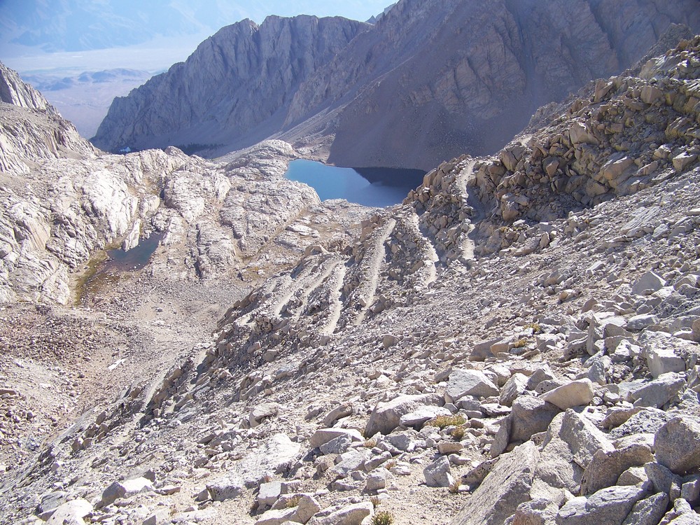
As it turns out, our friends are planning to hike Mt. Whitney this fall. Not only were they able to obtain a much sought-after day-use permit for themselves (a permit is required to hike on Mt. Whitney), but they had extra permits and invited us to join them on this demanding and extreme one-day hike! (I'm sure to some that doesn't sound like an enticing invitation. Our friends obviously know their audience quite well.)A view of some switchbacks on the trail. Photo credit: Cullen328, Wikimedia Commons

This was opportunity knocking. A chance to spend time with great friends and create unforgettable memories. An epic hike with my husband on new terrain. A possibility of checking off an item from the bucket list. I could feel that obscure and latent competitive gene of mine floating to the surface.

So then, why did I suddenly have a huge pit in the bottom of my stomach, feel apprehensive, and hesitate in immediately accepting their invitation? Oh, that's right: fear.

Fear of failure. Fear of not making it to the summit. Fear of getting altitude sickness. Fear of having to give up and turn around. Fear of not succeeding.

After mulling it over for several days, I realized fear is a pretty stupid reason not to even give it a try. How unfortunate (and dare I say, cowardly?) it would be to completely pass on this opportunity just because I'm afraid I may not complete the ascent. 

So, challenge accepted! We'll attempt to summit the 14,505 foot tall mountain in a single day via the Mount Whitney Trail

And even if failure becomes inevitable, I know it will still be an amazing day with incredible scenery, and it will be time well-spent with my husband and wonderful friends. I'll just have to submerge that competitive gene and save it for another challege.

Facts about the hike

  • Mount Whitney elevation: 14,505 feet
  • Total distance: 22 miles round-trip
  • Trail begins at Whitney Portal, elevation 8,360 feet
  • Elevation gain: over 6,100 feet
  • Timing: Requires 12 - 18 hours of strenuous hiking

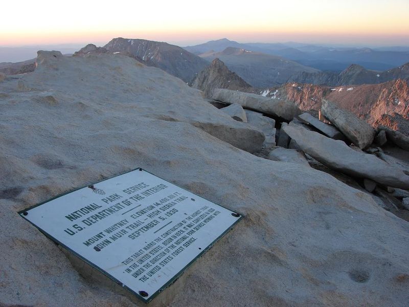
Plaque at summit of Mount Whitney. Photo credit: Wikimedia Commons


Big Sur: Yes, Sir!

Jennifer Ronda

Every camping trip we've ever taken always offers its own unique experiences, lasting memories, and fun times. Even though it had been over a year since our last outdoor adventure, our camping trip a couple of weeks ago was no different. The exception being that this time we decided to head down south to Big Sur, California. 

It had been years since we last made a trek to this part of the state, and we had forgotten how beautiful this area is. It truly is a special and magnificent place where the mountains of the west and rugged coastline abruptly meet the great expanse of the Pacific Ocean. Rocky outcroppings, pristine beaches, sheer drop-offs, enormous bluffs -- there are breathtaking views and blue waters everywhere you look. And let's not forget all the marine mammal sightings!

Kirk Creek Campground, Los Padres National Forest, Big Sur

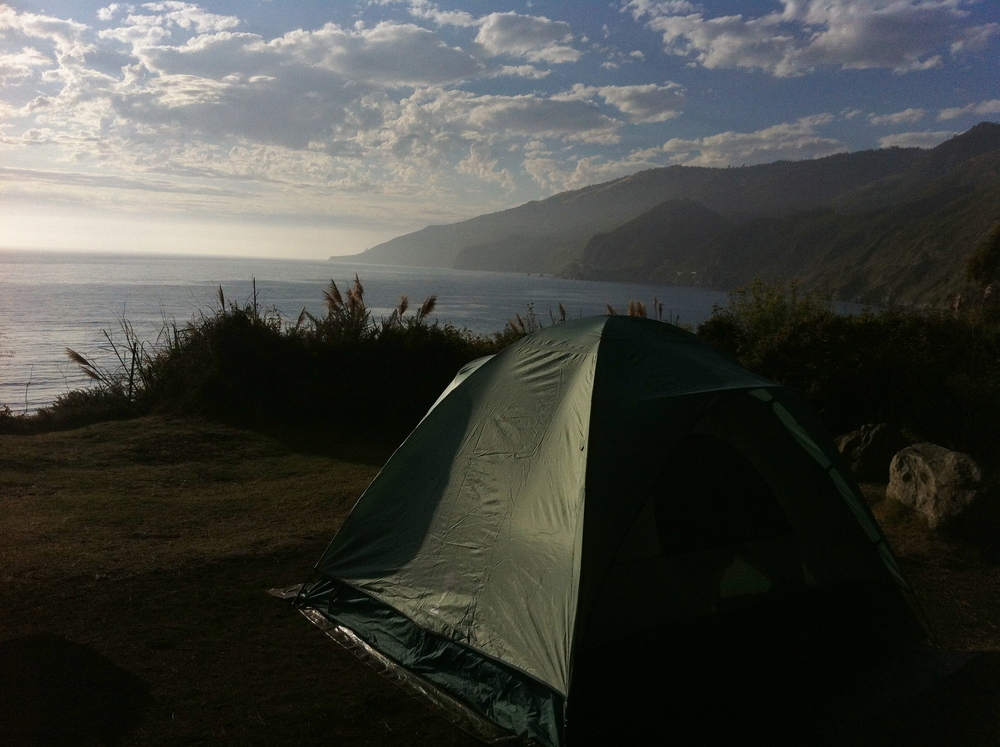
Our destination: Kirk Creek Campground. Listed by Sunset Magazine as the 6th best campground in California,Campsite #22 we were not disappointed! We pitched our tent on the coveted Site #22 which offered amazing views of the ocean to the west, the rugged coastline to our north, and the steep Los Padres Mountains to our east. Our campsite was a stone's throw from the edge of a bluff dropping off 100 feet to the ocean...literally. Seriously.

At dusk, we had a front-seat view to the setting sun and its changing colors; at Sunset over the Pacific Oceannight, we watched the display of stars on a completely black canvas, then drifted off with the waves of the Pacific Ocean lulling us to sleep. The morning view wasn't bad either: we spotted sea lions basking on a nearby rock outcropping and saw a school of dolphins swim by as we sipped our coffee.


Other Highlights from Big Sur

We definitely spent a lot of time just relaxing together and taking in all the views our amazing campsite had to offer. We also set out on a few adventures so we could explore some of the surrounding areas: 

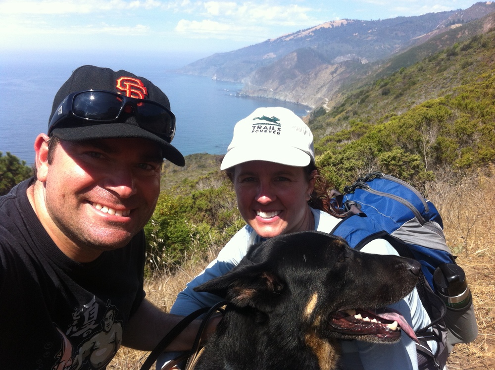
1. A long hike through the Ventana Wilderness and Los Padres National Forest. The constant incline of the trail was hard work, but we were rewarded with incredible bird's eye views of the rugged coastline, the ocean, the adjoining mountains, and even our campsite off in the distance!

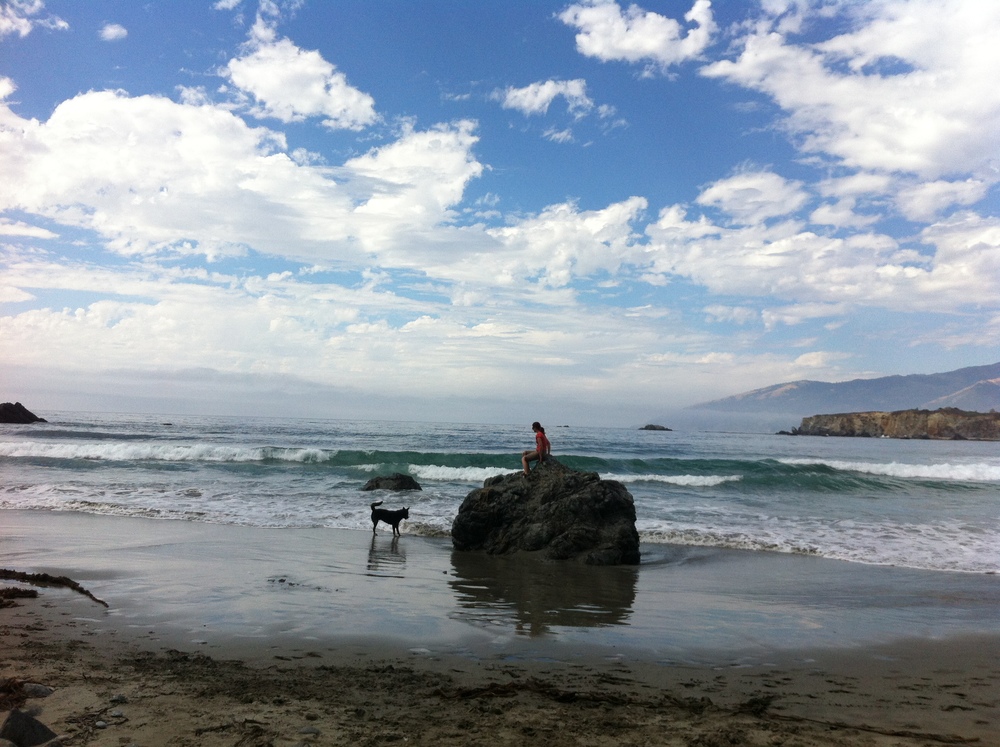
2. Beach time at Sand Dollar Beach. Our dog, Bear, especially enjoyed this outing as he got to splash around in the ocean and play an endless game of fetch!

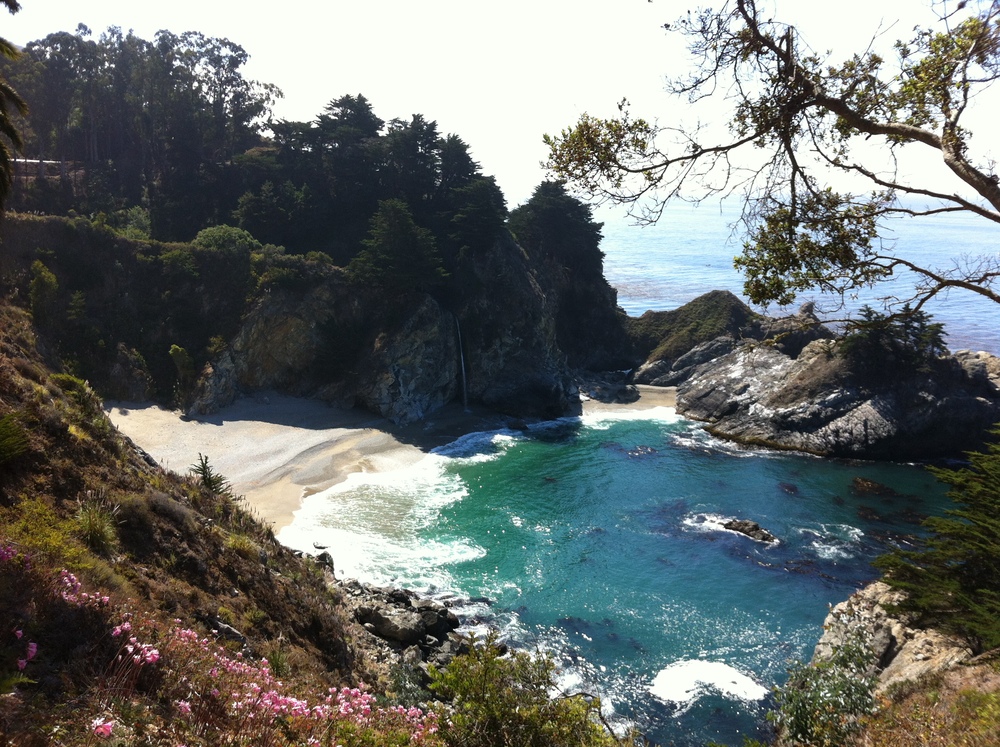
3. A visit to McWay Falls in Julia Pfeiffer Burns State Park. Tucked away in a picturesque lagoon, the waterfall drops 80 feet from a cliff to the beach, and is the only coastal waterfall in California.

McWay Falls, Julia Pfeiffer Burns State Park

Yes, sir -- Big Sur is a very special place, and all the better when you can pitch your tent right on the water's edge!